Navigating GOES GeoTiff Images
QUESTION: I download a number of GOES East and West GeoTiff images from this NOAA web page. Can you show me how to annotate these GOES images with continental outlines and map grid lines?
![]()
ANSWER: Yes. This is most easily done with the cgGeoMap program from the Coyote Graphics map routine library. I will use the file GoesEast04I23451615.tif from this web page in the example below.
First, I create a map coordinate object by reading the GeoTiff file. In this case, I also return the image so I can display it later on. (The image display can also be driven from keywords to cgGeoMap, but I think it will be more useful to you to see the individual steps in the process.)
   file = 'GoesEast04I23451615.tif'
   map = cgGeoMap(file, IMAGE=image)
Next, I create a window to display the image in and display the image with a two-percent histogram stretch.
   cgDisplay, XSIZE=900, ASPECT=image
   cgImage, image, STRETCH=2
Next, I make sure the map object is set up to cover the entire window, and I set up the map projection space.
   map -> SetProperty, POSITION=[0,0,1,1], /NOBORDER
   map -> Draw
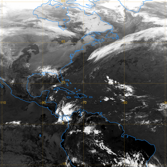
And, finally, I draw the continental outlines and map grid lines on the image.
   cgMap_Continents, COLOR='dodger_blue', MAP=map
   cgMap_Grid, COLOR='goldenrod', MAP=map, /LABEL
You see the result in the figure below.
 |
| A GOES East image with annotation. |
![]()
Version of IDL used to prepare this article: IDL 7.1.
![]()
![]()


